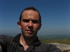
Parking at the top of the Gospel pass is easy in winter. Not so on a summer Saturday lunchtime. Fortunately I grabbed the last space and with a small pause to sort out kit I was off once more on a clockwise circuit.
Going underfoot was a little damp but the placed stones on Offas Dyke reduced the severity somewhat though the drop down to Capel y Ffin was far from present. The beauty of this walk though is the contrasts in views and the warm sun set the northern views off perfectly at the end of the day.
Showing posts with label black mountains. Show all posts
Showing posts with label black mountains. Show all posts
Friday, 24 July 2009


Wednesday, 8 October 2008
Trip report : Fan Frynach
Heading north on the A470 with a couple of hours to spare then why not take a break at the Cerrig Gleisiad nature reserve and wander within the Cwm or round its edge.
Plenty of options abound but with good clear sky and fluffy cloud I opted to walk into the cwm and pick up the moraine track before heading out just below the summit of Fan Frynach. Carrying on round the rim I took in Gleisiad and then headed back to the start on the steeper sE rim of the valley.
Highpoint of the day was a late dragonfly then it was on for an up and down of Fan Fawr
more photos

Plenty of options abound but with good clear sky and fluffy cloud I opted to walk into the cwm and pick up the moraine track before heading out just below the summit of Fan Frynach. Carrying on round the rim I took in Gleisiad and then headed back to the start on the steeper sE rim of the valley.
Highpoint of the day was a late dragonfly then it was on for an up and down of Fan Fawr
more photos
Wednesday, 20 August 2008
Trip Report : Foel Goch, Arenig

Tucked away on its own above Bala this is one of the least frequented summits in Wales. Before CROW only one right of way offered a line of ascent but with open access its open game on how to get here.
Looking for a change I stopped further north than usual by the entrance to Coed y Bedw (this is more open than the usual stopping point as per Nutall and may be safer)
Curving round behind the farm and little knoll I dropped down to Cwm Da then climbed the rough ground up to the col between FG and Moel Darren. Usually a hard but dry bet in summer this was a boggy slog today and only the constant views kept things going. the going eases at the col but the trig point was still a welcome sign.
From here the path east (care on the electric fences) takes you first to Orddu then beneath Bryn Bras before collecting the track I left at the start.
All told a nice variation on the direct ascent up the wet path of Cwm Da but the next visit to this route will most definitely be done in reverse.
Other photos from this walk
Sunday, 10 August 2008
Trip report : Monaidh Laidh
Overlooking Loch Laggan this combination of Munros and tops constitutes a grand day out over relatively easy going terrain once the summit ridge is reached.
Parking is offered by the reserve car park and the initial walk is over the friendly track into the Corrie. Keep to this until the track heads down to the river at the point clearly visible on the photo. Cross over and start on one of only two really hard climbs for the day. A series of zig zags allows you to reach the first of the four outlier tops from which it is a series of gentle loops to pick up the remaining three summits.
Track back on yourself from the last of the four then there is a steady climb up to the highest point in the range at 1130m. A breather at a simple cairn allows you to take in the remainder of the group before heading on to the vee in the ridge that would be the safe escape in bad weather or the way up for the Munro only ascent.
The continuation marks a series of steady ups and downs over easy terrain however on reaching the end at Coire Dubh you are left with a less pleasant choice.
A retrace to the final Munro of Carn Laith is not immediately attractive but having dropped down into the valley and negotiated the deer fence and overgrown tracks I have to admit it is possibly the best option.
A nice long walk worth saving for a good day and definitely the highlight of the trip

Parking is offered by the reserve car park and the initial walk is over the friendly track into the Corrie. Keep to this until the track heads down to the river at the point clearly visible on the photo. Cross over and start on one of only two really hard climbs for the day. A series of zig zags allows you to reach the first of the four outlier tops from which it is a series of gentle loops to pick up the remaining three summits.
Track back on yourself from the last of the four then there is a steady climb up to the highest point in the range at 1130m. A breather at a simple cairn allows you to take in the remainder of the group before heading on to the vee in the ridge that would be the safe escape in bad weather or the way up for the Munro only ascent.
The continuation marks a series of steady ups and downs over easy terrain however on reaching the end at Coire Dubh you are left with a less pleasant choice.
A retrace to the final Munro of Carn Laith is not immediately attractive but having dropped down into the valley and negotiated the deer fence and overgrown tracks I have to admit it is possibly the best option.
A nice long walk worth saving for a good day and definitely the highlight of the trip
Friday, 30 May 2008
Trip Report: Waun Fach Circular
There are few ranges in Wales that I have seen in so many different conditions. Today was no exception.
For once the sun was out although three days of heavy rain made the first half of the walk hard going, but I get ahead of myself.
There are many start points for this route but the Nutall option is one I prefer assuming there is enough parking space. A 10m min walk on the roads leads to a forest path now nicely widened and smoothed for the farmer. Care is needed else you miss the footpath sign and end up in the yard of a second home (watch the field gate its support is rotten).
From here its follow the track to the ridge and keep walking . The first half is boggy in the extreme and capped by the wade acroos the the trig point base on Fach. Then its a steady change of geology and dryness as we move round onto the western loop.
Descending from the final trig is problematic. A direct line to the car is possible but tough on the knees and even worse on the ankles once the bracken is up. Instead head towards table mountain before cutting the final corner to reach the footpath back round the hillside. Keep on this until after the small copse where a permissive path crosses one road before dropping you out 20m from where you left the car.

For once the sun was out although three days of heavy rain made the first half of the walk hard going, but I get ahead of myself.
There are many start points for this route but the Nutall option is one I prefer assuming there is enough parking space. A 10m min walk on the roads leads to a forest path now nicely widened and smoothed for the farmer. Care is needed else you miss the footpath sign and end up in the yard of a second home (watch the field gate its support is rotten).
From here its follow the track to the ridge and keep walking . The first half is boggy in the extreme and capped by the wade acroos the the trig point base on Fach. Then its a steady change of geology and dryness as we move round onto the western loop.
Descending from the final trig is problematic. A direct line to the car is possible but tough on the knees and even worse on the ankles once the bracken is up. Instead head towards table mountain before cutting the final corner to reach the footpath back round the hillside. Keep on this until after the small copse where a permissive path crosses one road before dropping you out 20m from where you left the car.
Subscribe to:
Posts (Atom)