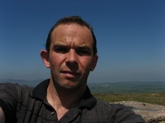
The last few weeks have been a bit thin on the ground for hill walking as preparing a new house (major renovation) has taken priority. However I cant let this short walk from the Ponderosa Cafe to the Trig point and masts go without note.
There is very little to it really just walk up on the track and return the way you came. That said the views of Worlds end, and the Clwydians make it worth the short 1h walk from the cafe car park
Monday, 21 April 2008


Sunday, 13 April 2008
Trip report :between Clarch and Aberystwyth
A trip with some friends gave me a chance to revisit my student haunts, sadly the tide meant the one mile run from town to Clarach was not on the agenda but instead a loop around the headland initially inland on the slope side paths then over the top of the golf course before cutting around the top of town and back over Constitution hill makes for a very pleasant afternoon stroll. Throw in a few geocaches and an ice cream on the top and the children were happy too

Monday, 31 March 2008
Trip Report : Eastern Arans
There is much that can be said in the negative about the hills that fall to the east of the main Aran Ridge but one view and one photo should be enough to tell you why they are a must do for a clear day.
Nowhere outside of central snowdonia does one ridge so dominate the day yet still leave scope to see other ranges or stunning valleys around and about.
The problem is the walk itself. No matter what you do for a circular at some point you need to bite the bullet of the Bwlch y Groes road and at others you have to face 3km of soft spongy peat.
Today I got the peat out the way first with cloud forecast I opted for the top of the pass expecting a wet slog back up. leaving the car park and keeping mainly to the right of the fence it is a long wet walk to the firt peat hag top. The views keep you going however and on reaching the summit the main Aran ridge lies before you. Turning right the track is immediately visible and much drier to the col. Keep on up the slope before cutting across the face of Esgeirion aiming for the top of AfonTwrch where a visible drainage cut runs across the face of Foel Rhudd follow this up to the fence if the weather is bad otherwise cut up on any one of the other smaller ditch lines to the summit.
Take in the northern view here before a simple following of the fence to the peaty top of Esgeiriau Gwynion.
Now the hard work begins a steep descent to the col and a steeper climb to Foel Hafod Fynydd provide a close up of the main ridge and a welcome breather and ideal late lunch stop.
Care is then required by all means follow the ridge and fence due east to the river but its a stiff 40m climb back to the track or steep descent and wider crossing further down. Far better to cut north about 200m down from the fence split on easy ground to a white walled abandoned sheep pen near the point the three northern rivers meet.
From there it is back along the track taking in the ever changing view to the road and the long steady climb to Bwlch y Groes. The tired can now return on the road to the start point but if you still have some energy left the final top of Moel y Cerrig Duon beckons along with its distant vista of Lake Vyrnwy.
Not a day for the wet but great on a clear day like today
More photos

Nowhere outside of central snowdonia does one ridge so dominate the day yet still leave scope to see other ranges or stunning valleys around and about.
The problem is the walk itself. No matter what you do for a circular at some point you need to bite the bullet of the Bwlch y Groes road and at others you have to face 3km of soft spongy peat.
Today I got the peat out the way first with cloud forecast I opted for the top of the pass expecting a wet slog back up. leaving the car park and keeping mainly to the right of the fence it is a long wet walk to the firt peat hag top. The views keep you going however and on reaching the summit the main Aran ridge lies before you. Turning right the track is immediately visible and much drier to the col. Keep on up the slope before cutting across the face of Esgeirion aiming for the top of AfonTwrch where a visible drainage cut runs across the face of Foel Rhudd follow this up to the fence if the weather is bad otherwise cut up on any one of the other smaller ditch lines to the summit.
Take in the northern view here before a simple following of the fence to the peaty top of Esgeiriau Gwynion.
Now the hard work begins a steep descent to the col and a steeper climb to Foel Hafod Fynydd provide a close up of the main ridge and a welcome breather and ideal late lunch stop.
Care is then required by all means follow the ridge and fence due east to the river but its a stiff 40m climb back to the track or steep descent and wider crossing further down. Far better to cut north about 200m down from the fence split on easy ground to a white walled abandoned sheep pen near the point the three northern rivers meet.
From there it is back along the track taking in the ever changing view to the road and the long steady climb to Bwlch y Groes. The tired can now return on the road to the start point but if you still have some energy left the final top of Moel y Cerrig Duon beckons along with its distant vista of Lake Vyrnwy.
Not a day for the wet but great on a clear day like today
More photos
Monday, 24 March 2008
Trip Report : Garreg Llwyd
This lovely little outlier of the national park is usually a quick dash from the car on the way home from Swansea or Carmarthen. But with a mixed forecast and my younger son wanting to go out geocaching I thought I'd make a bit more of it today.
Starting at the southern of the two main car parks I made straight up though the quary to the summit. Cloud was down but visibility ok at about 300m so no problems and on the summit it rose to give a decent view with the cairn offering some nice shelter for a bit to eat.
Then off almost due west for the first geocache near the roada bout 500m south of the car park then straight over and up to the "dewey" summit of Carn Pen-rhiw-ddu. Another easy walk but the top itself is a disappointment. The high point is marked with a scattering of stones with a more interesting cairn about 300m to the NE.
The views to the north are good value for the climb however then it was straight off the scarp and down to the second cache of the day just above the hairpin and back along the main road past a marker for a 19th century road accident and back to the car.
A nice stress free 3 miles with about 750ft on the up
More of todays photos

Starting at the southern of the two main car parks I made straight up though the quary to the summit. Cloud was down but visibility ok at about 300m so no problems and on the summit it rose to give a decent view with the cairn offering some nice shelter for a bit to eat.
Then off almost due west for the first geocache near the roada bout 500m south of the car park then straight over and up to the "dewey" summit of Carn Pen-rhiw-ddu. Another easy walk but the top itself is a disappointment. The high point is marked with a scattering of stones with a more interesting cairn about 300m to the NE.
The views to the north are good value for the climb however then it was straight off the scarp and down to the second cache of the day just above the hairpin and back along the main road past a marker for a 19th century road accident and back to the car.
A nice stress free 3 miles with about 750ft on the up
More of todays photos
Friday, 7 March 2008
Trip Report: Fforest Fawr
There can be few more remote walks in South Wales than crossing the Cnwer Estate on foot. Even reaching the start point in the Forestry at Blaen Llia involves several twisty miles on virtually single track roads.
Of course things are not as bad as they used to be, open access has cut the milage by a chunk and realistic circulars even in winter are now possible.
As normal for me I tackles the four tops anticlockwise. there is something about the watershed crossing that makes it far more pleasant after the first not the third climb of the day.
Equally common was the weather with cloud hovering around all morning then descending rapidly to make for a cold wet afternoon. One of those days just to put your head down and get going.
More Photos

Of course things are not as bad as they used to be, open access has cut the milage by a chunk and realistic circulars even in winter are now possible.
As normal for me I tackles the four tops anticlockwise. there is something about the watershed crossing that makes it far more pleasant after the first not the third climb of the day.
Equally common was the weather with cloud hovering around all morning then descending rapidly to make for a cold wet afternoon. One of those days just to put your head down and get going.
More Photos
Friday, 22 February 2008
Trip Report : Northern Carneddau
Putting together a visit to these hills is always a challenge in a day especially in Winter so the prospect of a conference in Llandudno was not to be missed out on.
The forecast was shaping up spot on as the weather cleared on the drive north but I had forgotten what 40mph in wind really means. Parking at the roadhead car park, I know Nutall suggests pull ins on the way up but they really passing spaces without the sign, I opted for Tal y fan first and a clockwise circuit from there this is a good choice especially if you follow the stream up that takes you onto Penygadair and direct to Pen y Castell as it saves a real road slog back to the car.
With the wind picking up Foel fras and Llwytmor were discarded and boy was I glad of it as I was pinned to the fence on numerous occasions as I walked off Drum to the pass.
More Photos

The forecast was shaping up spot on as the weather cleared on the drive north but I had forgotten what 40mph in wind really means. Parking at the roadhead car park, I know Nutall suggests pull ins on the way up but they really passing spaces without the sign, I opted for Tal y fan first and a clockwise circuit from there this is a good choice especially if you follow the stream up that takes you onto Penygadair and direct to Pen y Castell as it saves a real road slog back to the car.
With the wind picking up Foel fras and Llwytmor were discarded and boy was I glad of it as I was pinned to the fence on numerous occasions as I walked off Drum to the pass.
More Photos
Saturday, 16 February 2008
Trip report : Away in the Hirnants
(16-02-08)
Originally uploaded by Pete Roberts (rhayader_wanderer)

There is something about the Hirnants that can bring out the worst in you. Its really a no mans land between the Berwyns and the Aran ridges that struggles to peek over the 200ft level.
Its saving grace is a road that splits it in two and a forestry track that turns 8km of heather each way into something far more palatable.
Today however was a great day for the walk cold but no wind and the kind of hazy view that is the curse of the photographer in the hills but actually gives better results when looked at on screen at home. As normal I opted for the clockwise loop. I prefer a steep descent of Foel Goch not a slog climb up.
Not the greatest of walks better in the heather season but for a long stretch out after a frustratingly wet few months it was a great day
Monday, 28 January 2008
Trip Report : Cader Idris
 There is something about Cader that has the old friend about it. Possibly the fact that I only have a July visit left to see its trig point in every month of the year has something to do with it but today was not one of its crowning moments. The week long forecast for today being the best of the weekend broke on Sun evening and the high level cloud though "dry" was not clever and the wind was biting.
The loop from Minffordd is the obvious choice if taking in all 5 tops with only one driver and the and the stiff climb up though the woods is a great way to start the day. The path is easy and visible once you leave the trees behind but care is needed as you approach the large rock short of Llyn Cau else you miss the track up onto the ridge.
Path repair is ongoing with focus currently about 500m from joining the ridge as it steepens, its expected to take a while I think give the wooden hut that has appeared complete with tools and benches for the staff.
Diving off for one of 6 Geocaches immediately on the route the summit of Craig Cwm Amarch is the first stop. Onward again and after the col bear off at the fourth cairn to traverse under the main summit for Cyfrwy and another cache. A retrace and its on to the main summit and across it via 3 caches to Mynydd Moel.
Care is required in mist on leaving here initially to avoid walking off a cliff then a little later to ensure you don't cut into a valley instead of reaching the ridge to Gau Graig the final summit. remember as you approach to cross over the stile onto the right of the fence to get firmer ground.
Descent is easily off the end and round or the steeper right turn and aim direct. Either way you hit the road and the final cache before diving off on an old alignment back to the car
Photos
Thursday, 17 January 2008
Geotagging Photos
If like me you use Flickr you might have tried geotagging your photos. While this is easy in urban areas with clear buildings or monuments the same is not true of the uplands with most of GB covered only at satellite level.
However if you also use a GPS and keep a tracklog there is another alternative. Sanoodi, offers a free service aimed at runners and walkers interested in sharing GPS tracks as a logbook. The site is interesting in itself however it is the interaction with Flickr that caught my eye when it showed up as a referrer for one of my photo.
It works in two ways first it pulls in any public geotagged photo in the vicinity of your route but second and more important it allows you to take a GPX file upload it to the site then match the EXIF data from a Flickr set and locate where your photo was taken.
Its not perfect you need to approximately locate the first photo but a snap of your gps after it locks on as a working photo does the trick nicely. The main downside is a formulaic comment on the photo page linking back to the walk. It also only reads data from an uploaded Active track on Garmins save the track and the required data is lost.
It does however take alot of guesswork out of locating those remote photos
However if you also use a GPS and keep a tracklog there is another alternative. Sanoodi, offers a free service aimed at runners and walkers interested in sharing GPS tracks as a logbook. The site is interesting in itself however it is the interaction with Flickr that caught my eye when it showed up as a referrer for one of my photo.
It works in two ways first it pulls in any public geotagged photo in the vicinity of your route but second and more important it allows you to take a GPX file upload it to the site then match the EXIF data from a Flickr set and locate where your photo was taken.
Its not perfect you need to approximately locate the first photo but a snap of your gps after it locks on as a working photo does the trick nicely. The main downside is a formulaic comment on the photo page linking back to the walk. It also only reads data from an uploaded Active track on Garmins save the track and the required data is lost.
It does however take alot of guesswork out of locating those remote photos
Monday, 7 January 2008
Returning to the Radnor Forest
There is something about this simple circuit above New Radnor that keeps pulling me back. 20 minutes from home and a 3.5 hour round trip makes for an easy half day and its no surprise that it was the first set of hills that I have climbed in every month of the year.

Sunday was no different a simple walk past a local resident spray jetting the mud off the track up to his house, catching a mixed age group (youngest in a carrier eldest past retirement) and a steady open walk all the way.

Cloud could have stayed away but at least it was high. A nice simple start to the new year
Todays Photos on Flickr
Sunday was no different a simple walk past a local resident spray jetting the mud off the track up to his house, catching a mixed age group (youngest in a carrier eldest past retirement) and a steady open walk all the way.
Cloud could have stayed away but at least it was high. A nice simple start to the new year
Todays Photos on Flickr
Subscribe to:
Posts (Atom)