Wednesday, 4 March 2009

Trip Report : Garreg Las

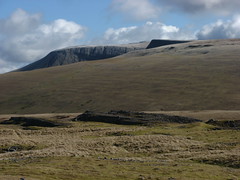
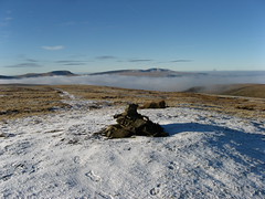
Garreg Las and the trigpoint on Carreg yr Ogof make for an interesting yet problematic trip. The peak bagger will pass the trig by opting for the long walk in from the SE or the shorter but no less demanding crossing from the west.

There is however a third option.

Take the back roads to the church at Llanddeusant with its youth hostel and find a parking spot. The lane S from the church has one by the river bridge but its not good if very wet.

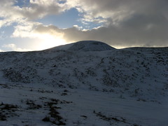
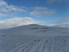
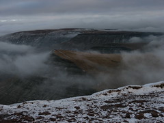
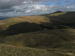
Continue up this road then track up onto the open hillside. Save this for a clear day as the going is not always the most obvious and the views east across the Carmarthen Fan make the day. Heading just west of south the trig point eventually appears then its onward over featureless ground to the twin cairns of Garreg las.

Its possible to continue from here but the way back is by no means direct from any of the other tops. Instead retrace your steps taking in the view to the north as you head back to your vehicle.

Fan Brycheiniog Mynydd Ddu Ridge Carreg yr Ogof Trigpoint, Mynydd Ddu Garreg Las

More photos from this trip

Wednesday, 11 February 2009

Trip report: Fan Fawr

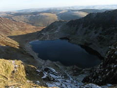
On a dry summers day with no wind Fan Fawr is a stiff but easy 40 minutes from the Storey Arms car park. Add in the remnants of the winters heaviest fall of snow and you can allow another half hour and a good use of crampons especially in descent.

None the less the walk remains simple and a great break on the way home from a meeting in Cardiff.


Beacons Reservoirs Northern Beacons panorama 12/2 components upper Glyn Tarrrell
All photos from this trip

Saturday, 7 February 2009

Trip report : Pen Plynlymon Arwystli

There is something about Plynlymon in the snow, perhaps its the central location with the extensive views or perhaps it just so easy to get to a point you can walk from. Whatever it is it a gem.

Route descriptions are superfluous on this occasion as the route from Eisteddfa Gurig has featured before but for a change I cut back and dropped into the valley far higher up than normal.


07-02-09 stitch3

07-02-09 stitch2a

Other photos from this trip

Thursday, 8 January 2009

Trip Report: Corn Du and Pen y Fan

Having taken a break, had lunch in the car met up with a friend we repositioned our vehicles at Pont ar Daf in the toilet car park half a mile south of storey arms.

From here there is what only can be described as a motorway to the summit. A dead easy walk for even the most remote happy couch potato in summer the intermittent layers of ice and slippery rock means a degree of respect is required at this time of year.

The only decision to be made is which first Cord Du or the Pen. We opted for the former as we had no plans to descend via Tommy Jones Memorial today and a good choice it was too. The cloud stayed with us for the first top but as we toasted my 40th birthday with a glass of chilled pinot noir (grabbed a red not a white by mistake) a few breaks began to appear to both north and east and we were treated to the imposing vista of the photographs.

After a careful retrace to the first col the descent was down on the motorway to round off a thoroughly enjoyable day


Celebrating my 40th on Pen y FanCribyn from PenyFanpdr_20090108_5849pdr_20090108_5853Celebrating my 40th on Pen y Fan

All photos from 8th January

Trip report : Cerrig Gleisiad/Fan Frynach

I don't often make a habit of repeating walks within 6 months but I made an exception here all be it in reverse.

With 3 hours spare before meeting up for an afternoon walk I decided to spend the first half of my 40th birthday in the hills around the Cerrig Gleisiad reserve and what a choice it was too.

First up the frost and snow made for steady going up the ridge but it soon became apparent that not only was the cloud laying with a small temperature inversion and the sun was breaking though.

sure enough on the ridge sun and cloud interacted and nature gave me a moderate quality Brocken Spectre as a birthday present. The route itself was as easy as ever and remembering to take the left of the two diagonals off Frynach itself cut the corner down into the reserve. A lovely start to a great day out


Other photos from this walk
Penyfan and Corn Du from Craig Cerrig GleisiadCraig Cerrig GleisiadClouds over the Fforest FawrBlack Mountain Range from Craig Cerrig GleisiadBrocken spectre on Craig Cerrig Gleisiad

All todays photos on Flickr

Trip Report: Y Gryn

Originally planned today as a stop on descent from the higher Beacons and instead opted for the quick out and back so as to avoid any ice on the rocks off the summit of Corn Du.

I've blogged about the route before so all that is left are the photos.

Fforest FawrFforest FawrFforest Fawr

All todays photos on Flickr

Wednesday, 7 January 2009

Trip Report: Cader Idris

If you asked most people to name two Welsh Mountains most would say Snowdon and then be stumped but a few would add Cader Idris as an immediate second choice.

Cader is an old friend for me I first climbed in in 1988 as a student leading a group of local scouts and its now almost reached the list of summits I have visited in every month of the year.

Today it had a few surprises for me, the first a whacking great £4 parking fee at Minfordd. Exit straight away and park in the layby halfway up the pass.

The next was how much fun it is to walk with a dog having been joined by a fried with a gorgeous pointer. The walk itself was classic Cader. Its a while since I climbed Gau Graig first and and this and Mynydd Moel were the aim for the day I left the layby and cut across hillside to the fence leaving two well wrapped up plane spotters on the ridge. From here its a straight climb up to the summit along the fence for the most part but occassionaly veering off to the right most notably at the obvious talus pile as you find a track thought the rocks.

The track finally bring you out on the much underrated Gau Graig, a little pimple walked the other way but a great viewpoint and sense of achievement after an hour.

The walk now unfolds before you heading West along the northern Cader scarp. This is a walk not to be rushed but neither one that overstresses the body despite appearances.

Passing the cairns of Mynydd Moel the trigpoint finally bursts into view against a foreground of white powder snow.

The other benefit of walking this way is that you are almost always facing the sun and at -9degress C on the way to the start that was more than welcome today. However sooner or later you have to drop into Cwm Cau and its shadow and sheets of ice on the hanging valley part of the path.

The final descent is via the woodland on the hillside wooden steps were added several years ago but they are starting to show signs of wear. For some the wood is broken and for many the gravel and soil has been washed out leaving an inch or more to trip the unwary descentant.

All told it was nice to revisit an old friend and nicer still to take a direction that I have tended to ignore in the past


More images from today
"Nutmeg"Catherine and Nutmeg approaching PenygadairNutmeg on Gau GraigMynydd Moel from Gau Graig

All todays photos on Flickr

Monday, 5 January 2009

Trip Report : Radnor Forest

I've blogged before about the delights of the hills above New Radnor. They are close to home for me and with a 3 and a bit hour walk time are an afternoon walk even in the depths of Winter.

And winter it was on new years day. The bright sunny sky of the day before was replaced with a blanket of freezing fog. Grey and atmospheric to the core.

Also freezing to the core as I found to my cost when the tube on my water pack froze solid after first use.

Route wise the only thing to add is that the path onto Great Rhos that appears to disappear on the map is now very distinct and goes to thing a couple of hundred metres of the trigpoint so there is no need to bash through the heather for a direct approach.


Other photos from this walk
New Years Day 2009New Years Day 2009New Years Day 2009Above the ford in the Harley Valley, RadnorshireNew Years Day 2009

Flickr archive

Wednesday, 24 December 2008

Trip Report: Gwastedyn from Rhayader

It had been a while since I have been out in the hills, work, weather and a series of small bugs have rather got in the way.

So with another cold stopping a trip onto the Drygarn I thought a short circuit of the hill overlooking town was a good bet for a couple of hours out.

Gwastedyn is to Rhayader as Skiddaw is to Keswick. Standing proud above town and within easy reach, so much so that the annual hill race is a feature of carnival week.

The walk from town is an easy circuit of about 1.5 hours if pushed 3 if lazed.

Head off down south street from the clock and keep on past he old toll booth (after first turning) residential home (2nd) and old workhouse no a nice hotel after the third. The path now becomes a roadside verge before turning off at the 2nd right of way sign on the corner.

A track leads up though the wood before bearing off to the left out onto the open hillside as your fence meets others coming up from the farm. The going is easy underfoot cut across the farmland for the next fence on the slope then curve around the headwaters of a small stream that drains the area below the summit.

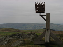
Keep "climbing" to the ridge fence but don't cross it instead turn right over one more fence that climbs the hillside to the summit cairn and commemorative beacon basket.

The second summit lies a couple of hundred metres away over one good and one not so good fence and a little rough grazing / bracken. Despite this it is worth the visit as it opens up the southern vista far better that the beacon summit.

From there head back to the ridge fence and follow this and a footpath back to the minor road above Gaufron and follow this then the A44 back to Rhayader itself.

Walk past both houses I have owned in town back to the clock tower and your start point.

If you miss the path and drop too early don't panic so long as you are on the Rhayader side head for the track between Bryn Du and Esgair-rhiw and follow this via the latter back to the road taking care to use the gates on the way down


Views of Gwastedyn

Sunrise on Gwastedyn Hill Gwastedyn sunrise 14-12-08 Gwaystedyn, Rhayader, 1/12/08

Gwastedyn sunrise 15-12-08 Gwastedyn sunrise 15-12-08

Views from Gwastedyn

Wednesday, 8 October 2008

Trip report: Y Gyrn


Y Gyrn
Originally uploaded by Pete Roberts (rhayader_wanderer)
The final leg of the day hardly seems like a real walk more like a 40min stretch of the legs.

Directions couldn't be easier cross the stile keep walking on the track till just before it drops into the valley. Follow a muddy path to your left and keep going to the fence high point is about 50m from the stile.

Retrace get back in the car and move on.

more photos